Layers of London project
Imagine you could peel back layers of history and see areas of London as they were at different times. With the Layers of London website, you can do just that and explore London’s history through maps. LMA is a major project partner and has provided mapping layers and themed collection images which appear on the maps. Kevin Sheahan describes the project and how you can explore London history in a fascinating new way.
Recording the layers of London's rich heritage
On the Layers of London website, maps from the modern Ordnance Survey to those of Victorian, Georgian and Stuart times have been overlaid on a modern geographically accurate base map. This allows us to see the lie of the land in a way never before possible. To add to those layers, maps generated from archaeological evidence have been created to take you back to Tudor London and the medieval period.
The website allows visitors to look these old maps of London and compare them with each other, and with the modern landscape. You can do this by layering maps from different periods over one another to compare and contrast. Users can see historic images and maps, as well as collaborate and contribute their own material to tell their stories on the site.
The LMA building on the Layers of London site
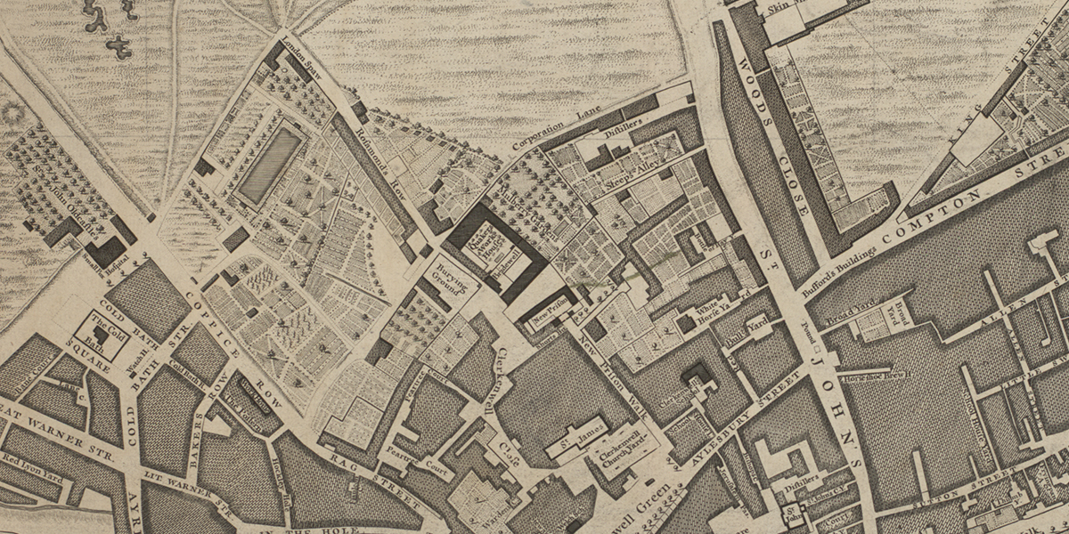
Using maps like this can reveal a much about the areas we know and can often reveal fascinating details and add depth to our knowledge of an area. If we look at the site of the LMA building on Northampton Road, we can use the layers to see what was here throughout the area’s history.
We start with modern satellite imagery which shows the LMA building, then peel back to bomb damage maps of the 1940s, which reveal that in the immediate area around LMA, the damage was relatively light (interestingly, the LMA building doesn’t appear, as the bomb damage maps were based on the 1916 Ordnance Survey - before the LMA building was built in the late 1930s).
Stepping further back to the late nineteenth century, OS maps reveal a mass of terraced housing on the site. Charles Booth’s poverty map of a similar date shows the area as a colour coded mixture of blues - ‘very poor’ and reds - ‘middle class / well to do’. Greenwood’s map of 1828 shows us a mixture of housing and open space, while Horwood’s map of 1799 shows a similar picture, but adds some detail like the names of some of the terraces - Vineyard Walk or Aris’s Row (just beneath the windows of the Information Area at LMA). Rocque’s map of the 1740s describes the LMA area as New Wells relating to the spas and spring waters for which the area was known (the names of which live on in the area in Sadler’s Wells and Spa Fields, for example).
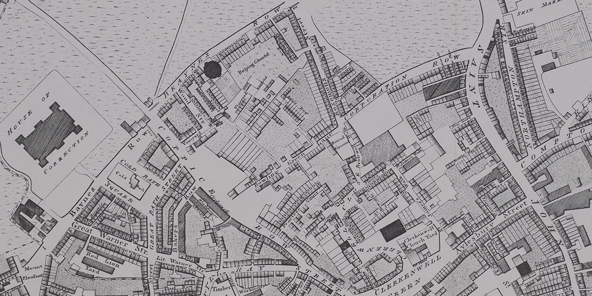
Ogilyby and Morgan’s map of 1676 finally shows us areas laid out as pasture and bowling greens (Bowling Green Lane is on the south side of LMA). Sadly, there are currently no earlier maps for the site of the LMA building, but in other areas they do go further back in time.
The Layers of London project
The continuing project is run centrally by the University of London Institute of Historical Research. LMA is one of the project partners, along with Birkbeck, Historic England, Museum of London Archaeology, The National Archives, the British Library, the National Library of Scotland and many more.
LMA’s contribution to the project was to supply some of the historical map layers (including our World War II bomb damage maps) and to provide pinned images with specific themes for the map layers. A project team at LMA trawled through our collections to add images and links to the photographic collections at LMA.
We have pinned 1000 images from the London County Council (LCC) photograph collection relating to specific themes within the images. Each photograph is shown at the exact spot on the map that the image shows, and includes additional details about what you are seeing, together with links to show similar images from the area on Collage: The London Picture Archive. The themes are: Housing, Education, Entertainment, Feeding London, Health and Welfare, Rescue, Transport and Film. In addition, LMA ran a volunteer project which sought to capture then and now photographs using the LMA collections to see old images of London, and to examine the changes which have happened since.
LMA is also running an ongoing mapping engagement programme to introduce users to the wider range of LMA map collections, including some which haven’t been catalogued yet. You can see what’s coming up by searching our listings on Eventbrite.
Get involved
The best way to appreciate the website is simply to go and use it! The Layers of London site is ready for you to explore now, so why not and take a look at your local area to see how time has changed it?